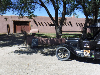
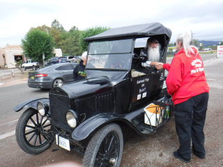
BY 1923 FORD MODEL T ROADSTER
| 40 Years ago
(1984) I made a backpacking/walking trip along with 3 friends and a
pack donkey, on the nearest roads we could determine, to follow the old
Santa Fe Trail. We started from Fort Osage, where the
original 1825 Government Survey of the trail began, near Sibley,
Missouri and walked to the Plaza in Santa Fe, New Mexico. The
distance we walked was about 980 miles and took us 91 days to complete
- 80 walking days and 11 rest days. (Click on "ABOUT LES"
above) Here I am on the 40th Anniversary of this adventure and have decided to attempt to travel the trail again. This time, I'm going to travel by car - a 1923 Ford Model T Roadster. It'll be a little faster than walking, but still slow enough that I can admire and take in all the beautiful scenery as I travel. I want to visit as many of the trail sites as I can. There have been so many places along the trail that have been "rediscovered" since I made my journey in 1984. There have also been several new advances that have taken place concerning the trail since 1984 - In 1986, the Santa Fe Trail Associaton was formed; in 1987, the Santa Fe Trail became a National Historic Trail; New maps, printed and digital, have been created of the trail; Geo-Caching is available along the trail; and New books have been published about the history of the trail. In my opinion, the greatest advancement that has taken place concerning the trail is the availability of Cell Phones for the everyday person. Digital maps of the physical trail are now available at your fingertips. Some of these maps, like the maps developed by the National Park Service, contain links to historic sites along the trail, with directions on how to find them. Cell Phones also allow a trail traveller, like me, the ability to find lodging, food, and, maybe most importantly, emergency facilities in case of illness or injury. We didn't have cell phones in 1984. If something would have happened to one of us, somebody would have had to run to the nearest farmhouse or town for help. Fortunately, we never had to do this. THE FOLLOWING is my journal of my 2024 journey along the trail in a 1923 Model T Roadster. My goal is to post something every day. I may not get to posting every day, but as oftern as I can. I will also be posting pictures of places I'm visiting. My journey is set to begin on September 9, 2024. I have no set agenda of travel. This trip may take 2 weeks or maybe a month. If the car breaks down, I may be done in a couple days. Only time will tell. Come back and visit often to read of my travels and adventures. |
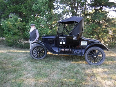 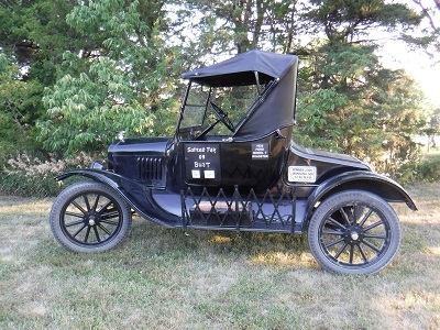 |
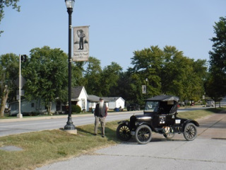
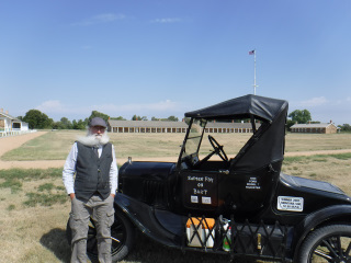
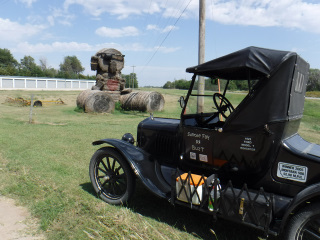
| Here are a couple shots of the 1923 Ford Model T Roadster before I leave on the Trail. The first photo is of me looking SouthWest toward Santa Fe. The second photo is taken a little closer to the car so everyone can read the sign on the door: "Santee Fay or Bust". |
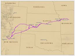 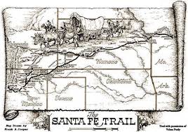 |
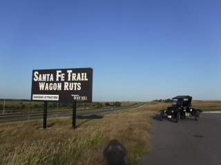
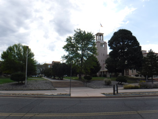
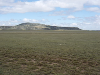
| This
will give you an idea as to where the Santa Fe Trail is/was. The
vast majority of the trail is on private land. I will be driving
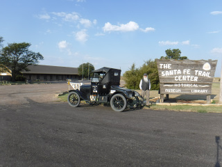
the nearest roads to where the trail used to be. You can visit this National Park Service webpage to view an interactive map of the Santa Fe Trail: https://www.nps.gov/safe/planyourvisit/maps.htm The Trail was in operation from 1821 until the Railroad arrived in Santa Fe in 1880. There may have still been a few wagons travelling the trail after the Railroad arrived, but the Railroad offered a much more economical option to hauling freight to Santa Fe. To read/learn more about the Santa Fe Trail, please visit the Santa Fe Trail Associaton website at: https://santafetrail.org/ |
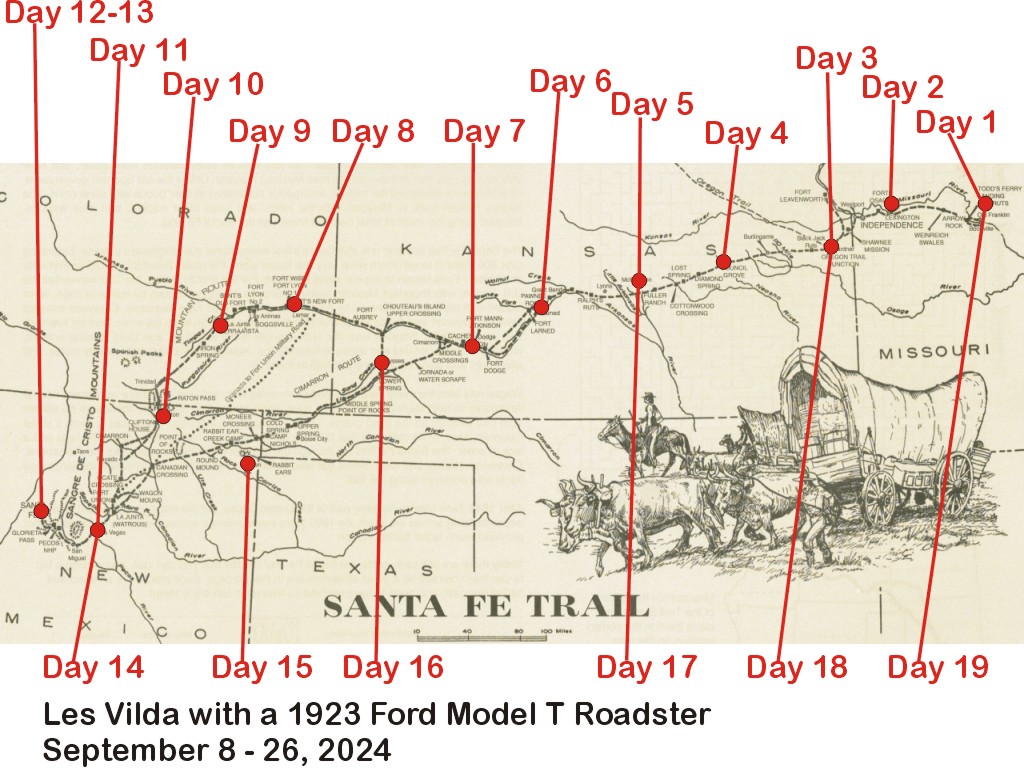 | ||
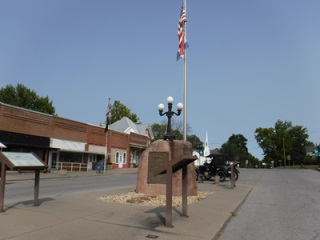
| 09/08/24 - Sunday - Day 1 I left Wilber about 8:15 AM today with my Suburban pulling an enclosed trailer containing my 1923 Ford Model T Roadster. I am pulling it to New Franklin, MO to start a drive along the Santa Fe Trail - Round Trip - going to Santa Fe by way of the Mountain Branch and returning on the Cimarron Cut-Off. I arrived in New Franklin about 2:45 PM. I drove to the church that the Thompsons found for me to park my Suburban and trailer in the parking lot while I'm on the trail. I unloaded the car, parked the Suburban and trailer and then posed for a photo in front of the church with the T. The Thompsons left and I drove to Main street to get a photo of the T and the giant granite rock marking the beginning of the Santa Fe Trail. I then drove South and West to visit and photograph markers, signs, and historic sites East/North (depending on which bend in the river you are talking about) of the Missouri River. In the early days of the trail, there was a ferry at Arrow Rock. The town is still there today, but no ferry and no bridge. Once I made it close to the Missouri River today, I'll drive over the bridge at Boonville and take the long way to Arrow Rock tomorrow. Today I got to see the site of Cooper's Fort (War of 1812 time period) and Boone's Lick (where salt was harvested from salt water in the area). | ||
 Granite marker in the center of Main Street in New Franklin, Missouri. | 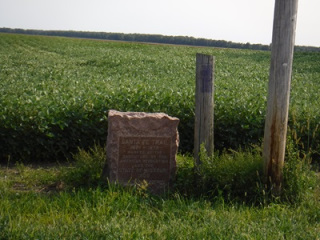 DAR (Daughters of the American Revolution) Marker at the site of Cooper's Fort. |  DAR Marker at Boone's Lick. |
| 09/09/24 - Monday - Day 2 I stayed overnight at the Historic Hotel Frederick in Boonville, MO. As I crossed over the Missouri River toward New Franklin this morning, the fog on the river was beautiful. Just as the sun was peeping over the horizon. What a time for my camera to be in the trunk! I had a wonderful breakfast in New Franklin this morning with members of the Howard County Historical Society. After breakfast, some of them followed me to Main Street to get photo of me next to the Big Granite Rock and under one of several banners they had made up for the Bicnetennial of the Santa Fe Trail (1821-2021). After the photo shoot, I was off for my first big day of driving. First stop was Arrow Rock, MO. Arrow Rock was named for a huge rock jutting out into the Missouri River that was triangle shaped - like an arrow head. I was told it first appeared on a French map of the area in 1732. All that's left of the rock is the triangle shapad base. The owner of the property was kind enough to meet me there and share information he has researched about the ferry crossing there. It was a narrow place on the Missouri River and required less effort to cross here than other places along the river. I also made a few quick pit stops at some trail ruts and at a spring/watering hole for the Santa Fe Trail travellers. My day ended in Lexington, MO. I drove a total of 86.5 miles today. It was brought to my atttention today that the numbers in my Model T license plate (2-6-6-2-5) add up to 21. The Santa Fe Trail began in 1821. Coincidence? Or, was I meant to be out here on the trail?? | ||
 Santa Fe Trail Signs along the streets in New Franklin, Missouri. | 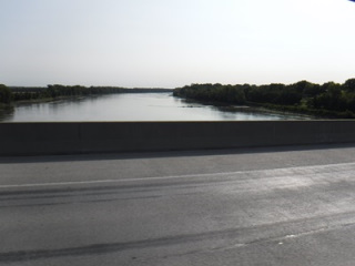 Crossing the Missouri River between New Franklin and Booneville, Missouri. | 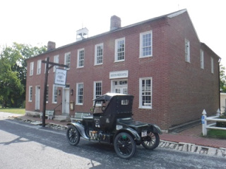 Huston Tavern in Arrow Rock, Missouri. |
 The Triangle shaped rock base of the once prominent "Arrow Rock" which stood at the Missouri River's edge. The river channel has moved leaving the rock base on dry ground. | 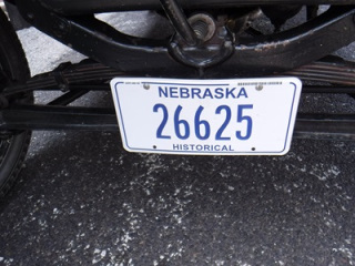 The numbers on my Model T car license plate add up to 21. The Santa Fe Trail began in 1821. | 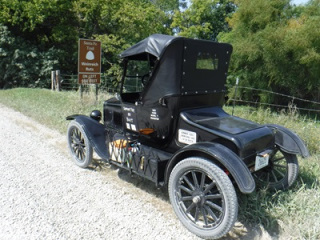 Site of Weinrich Ruts North of Marshall, Missouri. |
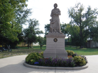
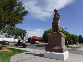
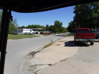
| 09/10/24 - Tuesday - Day 3 My day began at the Family Dollar store in Lexington, MO to purchase a set of Bluetooth earbuds for my phone. With the loud noise of the Model T, I can't hear the phone when it's telling me where to go. You would think that after all these years of having people telling me where to go that I would have it figured out by now. But, no. I was a bit concerned of making sure I knew exactly where I needed to go today since I'm driving all the way through Kansas City. If I take a wrong turn, who knows how I might have to get back on the right road. And, of course, the earbuds needed to be charged before I could use them. I just watched the little blue dot and anticipated how soon I needed to turn. It worked, but just a little more stress. All this electronic stuff. WHERE'S MY PAPER MAP??!!!!!! Next stop was the Courthouse in Lexington. It got shot during the Civil War and there's a cannon ball still in one of the pillars. After the courthouse, I stopped at the Madonna of the Trail statue a few blocks away. I am aware of 3 on the Santa Fe Trail: Lexington, MO, Council Grove, KS and Lamar, CO. A sign at the statue says there's 12 statues total across the country. I followed Hwy 224 West out of Lexington. I was driving right on the Santa Fe Trail for several miles. Next stop was Fort Osage in Sibley, MO. This is a reconstructed Government Fur Trading Post that also housed a group of Military Infantry. It's also the starting point for the first Government Survey (1825-1827) of the Santa Fe Trail. This was the place we started our walk along the trail in 1984. After Fort Osage about 15 miles, I was in Kansas City. I made several stops through the city. Most of them (I stopped at 9) were parks where wagon ruts could be seen. I did visit Cave Spring in Raytown, MO. This was a watering hole along the trail. Stories have it that the water used to gush out of the hole in the cave. The hole is about 4 feet tall and about 3 feet wide. In the 1950s or 1960s there was a church built to the NE of the cave. They used blasting to get through the limestone rock to build the foundation for the church. During the blasting, something happened to shift the water flow underground. Today there is but a small trickle of water coming out of the cave. The traffic coming through Kansas City was much calmer than what I was expecting. I got into the city about 10:00 AM. I had gotten a list of streets that were the closest to the old Trail from a member of the Mapping Committee for the Santa Fe Trail Association several weeks before I started this trip. I then sent the list to a member of the Kansas City Area Model T Club to make sure none of the streets threw up a red flag - as in "DANGER" - STAY OFF THIS ROAD. The entire list of streets were deemed safe to drive. I did well on all the streets until about 3:30 PM when schools let out. I was already South of the City on country roads headed for Gardner, but the traffic caught up with me. I drove through very heavy traffic for about the last 20 to 30 minutes of the day - until I parked at the motel in Gardner. I stopped for the day in Gardner, KS. I drove a total of 99.1 miles today. | ||
 Cannonball lodged in the Left pillar way at the top. Lexington, Missouri Courthouse. | 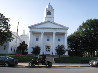 My Model T posing in front of the Lexington Courthouse. | 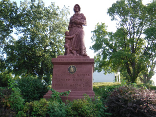 Madonna of the Trail at Lexington, Missouri. |
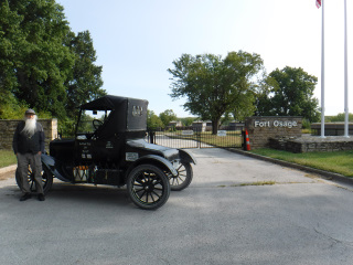 At the entrance to Fort Osage in Sibley, Missouri. | 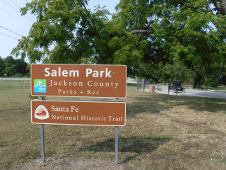 Salem Park, just East of Independence, Missouri along Highway 24. This was the first campsite for the 1984 Walking Group. |  Courthouse in Independence, Missouri. |
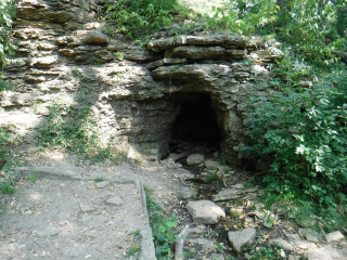 Cave Spring in Raytown, Missouri. | 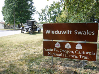 Site of Wieduwilt Swales (ruts) in Kansas City, Missouri. | |
| 09/11/24 - Wednesday - Day 4 I got a late start today - about 9:45 AM. Last night I tried to open Google Maps to see the route I was going to drive today. I drew out the route I wanted to take and dotted all the sites I wanted to see along the way before I left on this trip. Now it wasn't working. PANIC! In the beginning (while I was still at home), I couldn't send the maps to myself on my phone because my phone can't receive emails. Long story. Anyway, I emailed the maps to my cousin who opened them on his phone and then sent them to me in a text message (actually, I think it was his wife that sent them to me?). I called him last night to ask if he would send the maps to me again. He opened the next map I needed, to send it to me, and he couldn't see his map either. Double Panic! We worked on trying to get the maps back for nearly 2 hours. No luck. My next plan was to pull our my paper maps and I would have to write all the historic sites I wanted to see and highlight all the roads I need to travel. This was going to take some time and I thought I may have to stay in Gardner one more night so I had enough time to get all this information on the paper maps. I started working on the project this morning when I wanted to check a distance between towns on my phone (Google Maps). When I opened Maps, there was the map we were trying to open for 2 hours last night. It just magically appeared. I was able to use it all day. I saw a lot of wagon ruts today and numerous DAR Markers (Granite markers set along the Santa Fe Trail in the very early 1900s by the Daughters of the American Revolution). I travelled 110 miles today. I was on a lot of gravel and dirt roads trying to stay as close to the actual trail as I could. If I would have driven from Gardner to Council Grove (where I stopped for the night) on the highway, I would have only driven 92 miles. I left Gardner about 9:45 AM and got to Council Grove about 5:45 PM. Farmers are harvesting corn here like they are in Missouri. I ate a lot of dust today from the semi trucks hauling the corn out of the fields. The white rock they have on the roads here turns into an absolute powder. I have white dust where I didn't think white dust could get. | ||
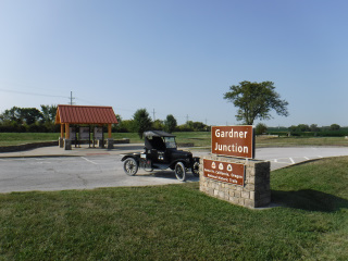 Gardner Junction where the Santa Fe Trail and the Oregon/California Trails parted and traveled in different directions. | 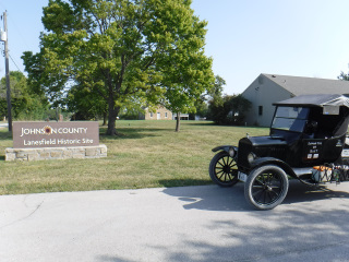 Lanesfield School. West of Gardner, Kansas. | 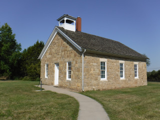 Lanesfield School. This school was built when wagons were still traveling the Santa Fe Trail. The Trail passed just North of the school. |
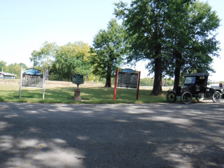 Signage at Black Jack Park Swales/Ruts - a short distance East of Baldwin City, Kansas. | 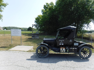 Palmyra Well in present day Baldwin City, Kansas. | 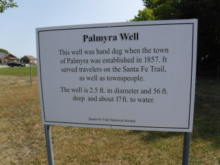 Sign at Palmyra Well. |
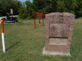 DAR Marker at Trail Park on the North side of Baldwin City, Kansas | 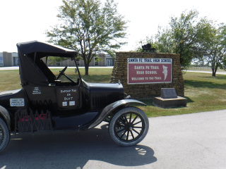 Overbrook High School - West of Overbrook, Kansas. The school was built on top of the Santa Fe Trail. | 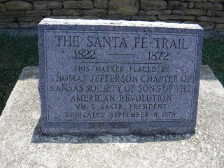 Sons of the American Revolution granite marker in front of the Overbrook High School. The only marker known to exist along the Santa Fe Trail set out by the Sons of the American Revolution. |
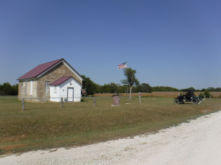 Wilmington School - built when wagons were still passing by on the Santa Fe Trail. | ||
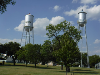
| 09/12/24 - Thursday - Day 5 I travelled from Council Grove, KS to McPherson, KS today. I had quite a long distance to travel today, so I got an early start - 8:00 AM. For me, that's early. The sun is up and I don't have to drive with lights on. The day started with a visit to the Kaw Mission in Council Grove. A stone school building that was built to educate the Kansa Native Americans in the 1850s. Today, it's a museum focusing on the Kansa People (who used to live in this area) and the Santa Fe Trail. While in Council Grove, I also vistied the Last Chance Store and the 2nd Madonna of the Trail Statue (1 more to go). Heading West, I visitied the ruins of the Six Mile Stage Station which is 6 miles SW from Diamond Spring (a major water source on the trial). I also visited Lost Spring and Cottonwood Crossing of the Cottonwood River near Durham, KS. My travels today took me down some VERY minimum maintenance roads. I was doing maybe 10 MPH on these roads. They were very bumpy! The good part of this is it took me to some areas that were still all prairie grass - with no trees. One could get a good sense of what the early trail travelers saw before trees started growing on the prairies. (There were barbed wire fences today, but no trees.) Very near the end of my day, I stopped in the town of Canton, KS. The only town I know that has a HOT and COLD water tower. The town officials really know how to take care of their citizens. No water heaters needed in any home in the city limits. All your hot water would come from the HOT water tower. Incredible! I pulled into McPherson about 4:30 PM. | ||
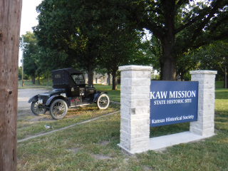 Site of Kaw Mission in Council Grove, Kansas. | 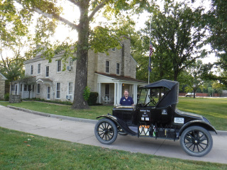 The Kaw Mission in Council Grove, Kansas. | 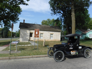 The Last Chance Store in Council Grove, Kansas. |
 The Madonna of the Trail in Council Grove, Kansas. | 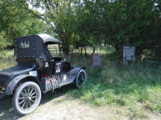 DAR Marker and Sign at the 6 Mile Stage Station West of Council Grove, Kansas. | 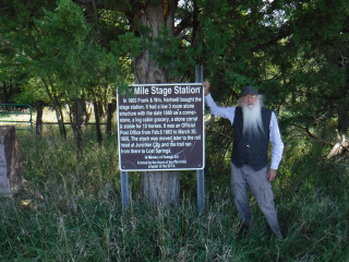 The sign at 6 Mile Stage Station. Named for being 6 Miles West of Diamond Spring - a prominent watering hole West of Council Grove, Kansas. |
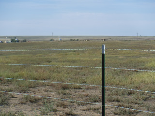
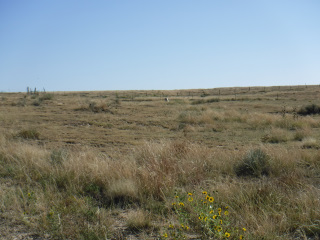
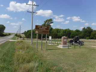 The site of Lost Spring Station near the present day town of Lost Spring, Kansas. | 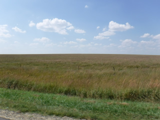 Treeless prairie West of Lost Spring, Kansas. (Except for the wood fence posts in the photo.) | 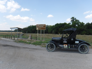 DAR Marker and signs at Cottonwood Crossing where the Santa Fe Trail crossed the Cottonwood Creek Southwest of present day Durham, Kansas. |
 Hot and Cold water towers in Canton, Kansas. | ||
| 09/13/24 - Friday - Day 6 Friday the 13th. I hope I have good luck today! I left McPherson this morning and headed South to see the site where George Sibley, leader of the first government survey of the Santa Fe Trail in 1825, met with Native Americans to arrange for safe passage of travelers on the Santa Fe Trail. The marker wasn't there. Not a good start for a Friday 13th. Heading West from there I came to the crossing of the Little Arkansas River. Lots of preserved wagon ruts and several interpretive signs telling about a military presence here and a stone corral. Next stop was Cow Creek Crossing and Buffal Bill's Well and a bit farther was Ralph's Ruts and Kern's Ruts. Then through Great Bend, KS to Pawnee Rock. This name is given to a town for the famous sandstone outcropping by the same name. Early travelers would etch their names in the soft sandstone as they passed by in their wagons. And, so did people traveling by in numerous years after the trail closed. You have to look close to find a name and date from trail days. I pulled into Larned, KS for the evening about 2:30 PM. I got a motel room and went directly to the laundromat to get some clothes clean. I didn't get back to my room till about 6:30 PM. People kept coming up and wanting to know where I'm gong and where I'm coming from . Around 4 PM, Leo Oliva showed up. He saw the Model T and thought it might be me. I was going to call Leo tonight to let him know I'm in the area. He wanted to come see the car when I got close. Leo was getting ready to leave and his car wouldn't start. It's a Hybrid - no key. One guy visiting about my trip happened to be a mechanic. He went home for a scaner and tools. He couldn't get the scanner to work on that car. There were others trying to help solve the problem of the car not starting. Someone suggested jumping the battery. They tried it and it worked. Leo went home and I came back to the motel room. I experienced the Death Wobble in the front end again this morning. As I pulled out of the motel parking lot, there was a narrow deep water drainage channel in the street. I hit it wrong and it got the wheels wobbling on the T. I had to come to a complete stop before the wobble quit. I made 104 miles today. | ||
 Site of Swanson's Swales (Ruts) South of Little River, Kansas. | 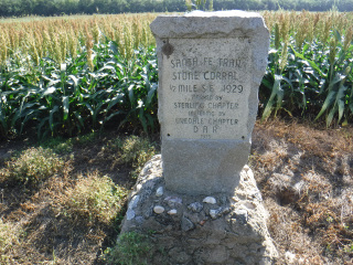 Site of the Stone Corral - South of Little River, Kansas. | 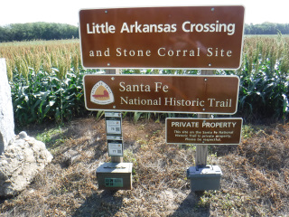 Site of the Little Arkansas River Crossing - South of Little River, Kansas. |
 Buffalo Bill's Well (under the roof) and the site of the Cow Creek Crossing. |  Ralph's Ruts West of Chase, Kansas. | 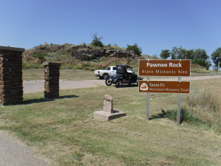 Pawnee Rock just North of the town of Pawnee Rock, Kansas. |
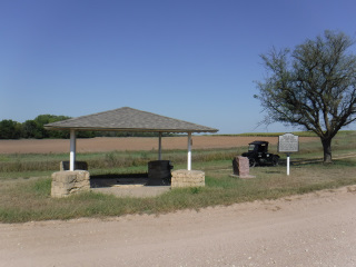
 Marker and shelter on top of Pawnee Rock. | ||
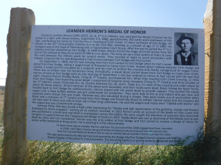
| 09/14/24 - Saturday - Day 7 I didn't have very many places planned to visit today. Little did I know of all the things I would find along the way. I started off at the Santa Fe Trail Center a few miles West of Larned, KS. The exhibits in the main building are very nice. They take you from days of Native Americans on the prairie to the mid 1900's in Central Kansas. Then, you go outside and start on the "out buildings" - Sod house, dugout house, 1 room school that "Doc" from GUNSMOKE went to school in, church, railroad depot, cooling house, farm equipment, vehicles, etc. The 2 ladies working there today asked if they could have a ride in the Model T. I took each of them around the museum grounds. Then I'm off to Fort Larned. This was a few miles farther West of the Santa Fe Trail Center. There have been a lot of changes to that place since last I was there in the early 1990's. The buildings and rooms are equipped with what was there in the 1800's. Amazing! The fine folks at the Fort asked me if I would like to pull my Model T between a gap in the buildings and get some photos. You Betcha!! Those were some great photos! Just outside of Garfield, KS I saw a tractor on the side of the road that reminded me of hazards of traveling by wagon on the Trail. Like broken axles or broken wagon wheels. I saw no evidence of the tractor rolling on its side, but it looks like it might have been very close to that. On the East edge of Kinsley, KS I saw this giant teddy bear made out of hay bales. I had to stop for a photo. On the West edge of Kinsley I got a photo at the Edwards County Museum with an old Steam Locomotive and the sign that tells you the miles you need to travel to get to New York and to San Francisco. Farther down the trail I got to get a photo with a gas pump that supplied gas for all the neighbors and passers-by in the late 1920's and 1930's. It was one of those old pumps that you needed to pump a long handle to get the gas to go through the hose and nozzle. The next photo is of a sign along the county road about a Fort Larned soldier receiving the Medal of Honor and the story of how he earned it. The story is fascinating. Blow up the photo so you can read it. The visitor center at Fort Larned has a recording of the radio interview with this guy in the early 1930's. He tells this story in his own words - in his own voice. The recording plays at the push of a button as part of one of the exhibits. I listened to it before I came to find the sign. WOW! I traveled 93 miles today, but it took me from 8:30 AM till 5:30 PM to travel that far. I drove as far as Dodge City, KS today. 2 guys and a woman (driving) stopped me by a Lutheran Church out in the country to talk about my car. I saw them a few minutes later parked in the middle of the county road. They had me follow them to where they used to live. It was a place called "the Half Way House" - where, in the 1800's, the people who lived there at the time sold eggs, milk, and butter to the wagon trains passing by on their way to Fort Dodge. A bit West fo the house is a SFTA (Santa Fe Trail Association) marker for wagon ruts in a pasture. | ||
 The Santa Fe Trail Center -West of Larned, Kansas. |  Fort Larned - West of Larned, Kansas |  Foot bridge crossing the Pawnee Fork - Entrance to Fort Larned. |
 Fort Larned Enlisted Men's Quarters behind Les and the Model T. | 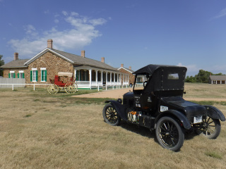 Officer Quarters next to the Model T. | 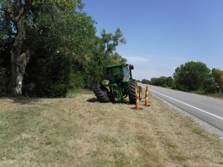 Rear wheel broken off of a John Deere Tractor - West of Garfield, Kansas. |
 Teddy Bear made from Big Round Hay Bales - East end of Kinsley, Kansas. | 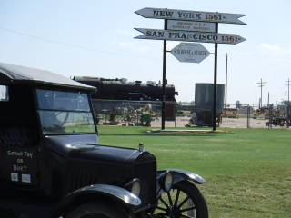 West side of Kinsley, Kansas at the Sod House Museum - marking equal distance to New York and to San Francisco. |  Les pretending to pump gas from a 1920's era gas pump. |
 Medal of Honor recipient story. East of Fort Dodge, Kansas. | 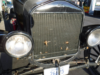 Grasshoppers are starting to plug up the radiator on the Model T. | |
| 09/15/24 - Sunday - Day 8 I spent the night in Dodge City, KS last night. I wanted to get an early start this morning just in case I needed to beat the shift change at the beef packing plants here. Traffic gets very heavy during rush hour. I was told those folks work 7 days a week. I think they lied to me. Traffic was quite slow this morning. I had only a few spots I wanted to stop at between Dodge City and Lamar, CO, so I decided to try to drive the entire distance in one day (154 miles). I made it. I left Dodge at about 8:15 AM and got to Lamar about Noon thirty (12:30 PM - Mountain Time - 1:30 Central Time). It took me about 5 hours to get here - including a few stops for photos. I stopped at the ruts West of Dodge City along Hwy 50. They remade the entrance, parking lot and trail since last I was here. If you look down the sidewalk, the ditches are the wagon ruts coming down the hill. What an interesting way to show you where they are. West of Deerfield is Charlie's Ruts. Another deep set of ruts coming down a hill. They also have a metal sculpture/cut out of a wagon in the field by the sign. I crossed into Colorado today. In Lamar, I vistied the 3rd of 3 Madonna of the Trail Statues along the Santa Fe Trail. I also spotted a building along the highway stating that it was made entirely of petrified wood. I had to get a photof of it also. I wanted to visit the Big Timbers Museum in Lamar, but Google tells me they are closed till Tuesday afternoon. We visited there in 1984 and I thougth it was a very interesting museum. I wanted to see what changed in 40 years. I'll be spending the night in Lamar. Several Museums and sites to see tomorrow. I drove about 40 MPH from Dodge to Lamar. I made 154 miles on 1 tank of gas. I'm impressed with the gas mileage this thing is getting. The Google My Maps did not work for this section. I'm going to try to remake the maps today on Google Maps - since I got into a motel ealry, I have time to wrok on it. As I was working on the new Google Maps, I saw that it was sunny one minute and the next time I looked up, it was dark and raining cats and dogs. The wind came up so hard that at one point, I saw a large metal trash dumpster (the kind on wheels) rolling at a brisk rate of speed across the motel parking lot. Glad my Model T wasn't in it's path!! I didn't know it was supposed to rain today. My car side curtains are off and the car is getting a washing on the inside and outside. | ||
 Santa Fe Trail Ruts - West of Dodge City, Kansas along Highway 50. |  Foot Bridges at the Santa Fe Trail Ruts West of Dodge City, Kansas. |  The low areas under the bridges are the ruts of the Santa Fe Trail. |
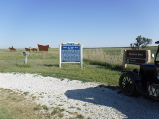 Charlie's Ruts West of Deerfield, Kansas. | 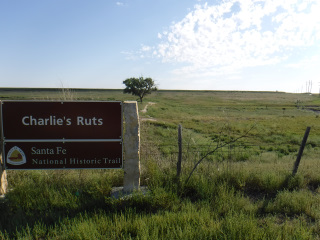 Charlie's Ruts - You can see the ruts coming down the hill to the right of the tree in the background. | 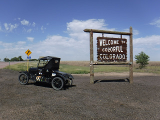 Entering Colorado on Highway 50. |
 Madonna of the Trail in Lamar, Colorado. | 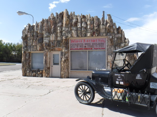 Building made of Petrified Wood in Lamar, Colorado. | |
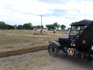
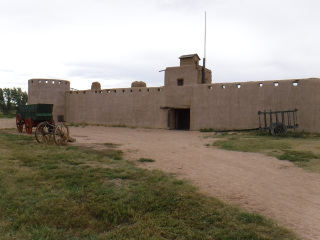
| 09/16/24 - Monday - Day 9 I started today in Lamar, CO and ended in La Junta, CO. I travelled 77 miles today. I made the Google Maps yesterday and I couldn't get the Lamar to La Junta map to work after the first stop. I've been on this part of the trail several times by modern car, so I had a fairly good idea where I wantd to go. I wanted to visit the Big Timbers Museum in Lamar. It was closed. I went on to the site of Bent's New Fort. Since it rained, I chose to not walk in the mud to visit the site this time. The road leading out of there was a bit muddy. My tracks in the photo are the narrow ones - not the wide, side to side tracks. I vistied the Joh Martin Reservoir where there are wagon ruts and a mushroom type rock named Red Shin Standing Rock. The photo has the story. When I arrived at the visitors center, I found out that the ranger's relatives live in Crete, NE - only 10 miles North of my home town of Wilber. What a small world! At the tail waters of the Reservoir is the new Fort Lyon. The chapel just inside the front entrance was made with the stones that were once the hospital at the fort. The hospital was where Kit Carson died in 1868. My next stop was at the site of the town of Boggsville. This is where Kit Carson lived at the end of his life. When he got sick, he was taken to Fort Lyon, about 7 miles away. Boggsville is about 2 miles South of present day Las Animas, CO. Some of the homes have been re-built and furnished like they would have been in the 1800's. It's my opinion that the people working on theis project are doing a wonderful job. Adobe buildings require a lot of upkeep. These look wonderful! Just across the highway from Boggsville is the Las Animas Cemetery where William Bent (of Bent's Fort fame) and John Prowers (a prominent cattle man who lived at Boggsville) are buried. I then headed down the road to Bent's Old Fort near La Junta, CO. The new superintendent did away with all the living history interpreters at the fort. It's just a large mud (adobe) building with static exhiibits now. I was very saddened to see the fort in this condition. It used to be "alive". The skies were very dark this afternoon, so I put the side curtains on the Model T while I was in the Bent's Old Fort parking lot. This was the first time I'd put the curtains on by myself. It took longer than I had expected. I'm glad I took the time to do this. Next time I may have to get this done in a hurry, if rain is really threatening. The last photo is what the Model T looks like with "doors". | ||
 The White Monument directly above the steel post is the site of Bent's New Fort - West of Lamar, Colorado. |  Santa Fe Trail Ruts crossing the County Road North of Bent's New Fort. |  County Road West of Bent's New Fort. It rained a lot the night before I was there. |
 The White Marker in the center of this photo marks the center of a wagon rut coming straightt toward the camera. West of Bent's New Fort. | 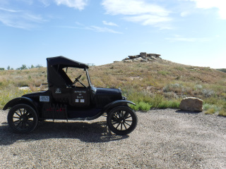 Red Shin's Standing Ground- East of John Martin Resivoir's Dam near Hasty, Colorado. | 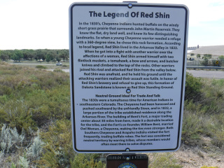 Sign explaning the story of Red Shin. |
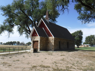 Chapel at Fort Lyon made from the stones that were once the fort Hospital (where Kit Carson died). | 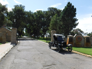 Entrance to Fort Lyon, Colorado. | 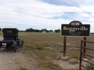 Sign at the site of the old town of Boggsville - South of Las Animas, Colorado. |
 Some of the restored buildings at the site of Boggsville. | 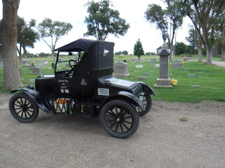 William Bent's tombstone (behind the Model T - tall stone with an urn on top). | 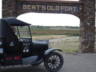 Archway announcing Bent's Old Fort - East of La Junta, Colorado. |
 The main/front entrance to Bent's Old Fort. |  What the Model T looks like with its side curtains on. Photo was taken at the La Junta Inn Motel in La Junta, Colorado. | |
| 09/17/24 - Tuesday - Day 10 Today I drove from La Junta,CO to Raton, NM - a distance of 110 miles. La Junta to Trinidad, CO is a distance of about 70 miles. There are no gas stations in that distance. There is not much of anything in that stretch of road. Since this is tarantula migraton season, I did see a few of those little guys crossing the highway through that stretch. I counted 7 live ones. I pulled into the picnic area in Timpas, CO, or what's left of the town. Several interpretive signs about the Santa Fe Trail and about the attempt to farm that country. One of the signs had a map and instructions on how to follow a hiking trail 3.7 miles in the wagon ruts of the Santa Fe Trail. How cool is that??!! The picnic area was also the trailhead for this hike. A few miles West of Timpas is the Iron Spring watering hole. The spring itself is still providing water. It is on private property, so I didn't get to see it. The guide book I'm following says that the spring has been diverted to fill concrete watering tanks for cattle. Across the county road from the spring is a parking area with interpretive signs telling of the history of the area. They also point out a wagon rut that has had limestone posts placed vertically in it - so you can follow it for maybe half a mile (?). Once again, a person has the opportunity to walk right in the wagon rut of the Santa Fe Trail. I'm impressed! Farther West is what is left of the Thatchr (town) schoolhouse. West of the school is a small canyon running North. A short ways North of the county road was the site of Hole-in-the-Rock watering hole. The Guide book says the spring dried up. I know the site is on private property. Maybe the landowner just doesn't want "Looky-Loos" like me trespassing to try to find it. From numerous miles East of Trinidad one can see a prominent flat topped peak known as Fishers Peak. It marks the entrance to Raton Pass. Trail travelers have used the peak to guide them to the pass. The weather report for the Trinidad/Raton area today called for heavy thunderstorms (70% chance). As I'm driving toward Trinidad, I see dark clouds moving East on what looks like the other side of the mountains from Trinidad (on the Raton side). I travel a bit farther and the dark clouds leave and are replaced by thick white clouds that hover over the moutain tops like wipped cream on a cake. Blow that photo up, I think you'll agree. I got to the top of Raton Pass and got out to look at some Santa Fe Trail signs (that I never found). It was cold, damp, and very windy, but no rain. Actually, I've been driving in heavy wind ever since I left La Junta at about 8:00 AM (I'm on Raton Pass shortly after Noon). At some points, I had the car maxed out on gas (I had no more throttle to give it), and I could barely keep up a 25 MPH speed. I get to Raton about 12:30 PM and get a motel room. The sky just keeps getting darker. About 2 PM, it starts to rain. I drove all day with the side curtains on. Coming up Raton Pass from the North was interesting. The car did very well for all (about 9 miles) but the last 3/4 to 1 mile to the top. The road increased in steepness and I had to downshift to get up to the top. But, it made it!! I was driving about 30 to 35 MPH, as I do on all the highways, until I got to the steep part. After I down shifted, I was able to keep up a speed of about 25 MPH. | ||
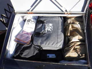 A packed trunk in the Model T. It was packed tight. I didn't have to worry about things shifting while I was driving. | 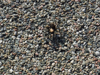 A Tarantula crossing the highway West of La Junta, Colorado. | 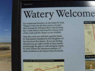 Sign with invitation to walk along the Santa Fe Trail Ruts AT THAT SITE at Timpas, Colorado. |
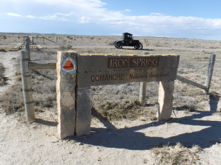 Iron Spring Interpretive Sign area - West of Timpas, Colorado. | 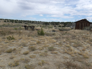 Iron Spring (Left and beind the building about where the trees begin.) | 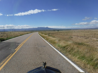 Fisher's Peak (point on the right side of the mountain) which marks the entrance to Raton Pass at Trinidad, Colorado. |
 Fisher's Peak - point at right side of the mountain. | 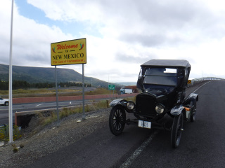 Entering New Mexico - at the summit of Raton Pass between Trinidad, Colorado and Raton, New Mexico. | |
| 09/18/24 - Wednesday - Day 11 I traveled from Raton,NM to Las Vegas, NM today. A total of 165 miles. Today was the first day I saw large wildlife. As I got close to the Whitington NRA Shooting Range, South of Raton, I started seeing antelope in the distance off the highway. I saw antelope periodically all day. I also saw 2 small herds of mule deer as well as a few small dog towns (Prairie dogs). I pulled into the NRA Range to view the display they have sitting right next to the Santa Fe Trail ruts on their property. From there, I continued down Hwy 64 to Cimarron. I wanted to see the inside of the St. James Hotel. It was closed when I was there in 1984. Guess what? It was closed this time also. They just closed its doors this past Monday - like, 2 days ago. What timing I have! Since it was closed, I went down the street to the Aztec Mill. It was closed for the season. I found a cafe open. Found out it used to be a stage station back in the trail days. Down the road a bit was Philmont Scout Ranch - a High Adventure backpacking camp for scouts. I attended for 4 years during my scouting days - three times as a scout and once as an assistant leader. Part of the scout ranch is a complex of buildings in the old town of Rayado - South of Philmont headquarters. Kit Carson used to live in Rayado. His home has been turned into a working museum for the scouts. In 1984, we were given permission to camp in the courtyard of the home. The donkey had to camp outside the courtyard. South of there quite a ways is the town of Wagon Mound. I took a photo of my car with the Wagon Mound in the background. The name for the "hill" supposedly came from the fact that it kind of resembles a wagon being pulled by animals off to the right of the wagon - as in the direction my car is pointed. From there I went to Fort Union. This place is 8 miles off the main road. Well worth the drive though. This is where I got the close up photo of the antelope. He did not want to get off the road to let me pass. The last photo I have with this post is of the rubber seal from between the upper and lower panes of glass in the windshield. I was close to Las Vegas and the wind was blowing very hard from the SW....and I was driving SW. A grasshopper flew up and was headed for my windshield. I watched it hit right in between the glass panes and hit the rubber seal. It pushed the seal out of place for maybe 8 to 10 inches. That was one hard hitting grasshopper! I had to get out of the car to reset the rubber seal. | ||
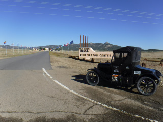 Entrance to the Whittington Center (NRA) South and West of Raton, New Mexico. | 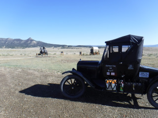 Wagon and sculpture display at the Santa Fe Trail Ruts at the Whittington Center. | 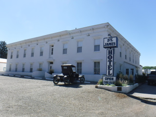 St. James Hotel in Cimarron, New Mexico. |
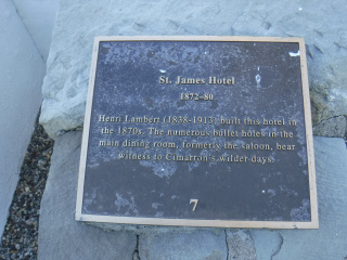 Sign at the St. James Hotel in Cimarron, New Mexico. | 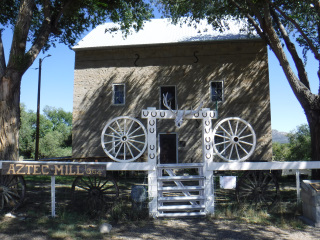 The Aztec Mill in Cimarron, New Mexico. |  The Aztec Mill (now museum). Photo taken from behind the entrance fence/gate. |
 Sign at the Cimarron Merchantile and Cafe in Cimarron, New Mexico. | 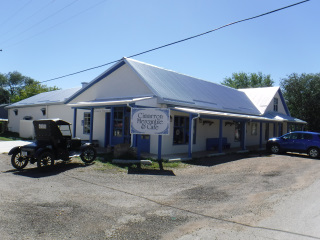 The Cimarron Merchantile and Cafe in Cimarron, New Mexico. |  Entrance to Philmont Boy Scout Ranch camping area. The "Tooth of Time" is the white rock point on the upper left of the photo. South of Cimarron, NM. |
 The Kit Carson Home and Museum on Philmont Scout Ranch at the site of the old town of Rayado, New Mexico. | 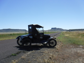 Wagon Mound (can you see the wagon and the animals pulling it to the right?) - the town of Wagon Mound, New Mexico is at the base of that hill. | 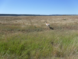 Antelope at Fort Union near Watrous, New Mexico. |
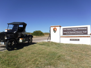 Entrance to Fort Union - about 8 miles North of Watrous, New Mexico. | 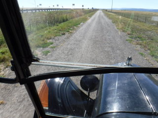 While bucking a strong SW wind coming into Las Vegas, New Mexico, a LARGE grasshopper caught a tail wind, hit the windshield and pushed the rubber seal out from between the panes of windshield glass. | |
| 09/19/24 - Thursday - Day 12 I traveled from Las Vegas, NM to Santa Fe, NM today. I put on 80 miles today. A short distance West of Las Vegas is Starvation Peak. At the base of that peak is the town of Bernal. I stopped at the Bernal store. The store has been in operation since Trail days. A short distance West of Bernal is San Miguel. I pulled in there to get some photos of their church. Built in 1806. West of there is the town of San Juan, a favorite crossing of the Pecos River for wagons. It is believed that the crossing was where a steel bridge was later built for Route 66. The bridge is still there, but since the higway moved to become I-25, the bridge is no longer used. I made a pit stop at Pecos National Monument. It's the ruins of a Pueblo that existed in the 1500's (I think). We got our picture taken at the ruins in 1984, so I stopped to get my photo taken again for this 40th Anniversary. I took a photo of a General Store in the town of Pecos,NM. In 1984, this store was like walking into a time warp. They carried tinware, enamelware, wood handles for axes and etc, items that one might associate with the late 1800's and early 1900's. It wasn't a museum, this stuff was really for sale. Now the store is closed and the neighbors say there is no talk of reopening it. They pointed down the street at a Dollar General store and told me that was their new Genreal Store (the tone of their voices were that of sarcasm). A few miles West of Pecos is the Pigeion's Ranch Stage Station. This operated during trail days amd was also the area of the Battle of Glorietta Pass - a decisive battle during the Civil War. About another 10 miles and I was in the city limits of Santa Fe, NM. I pulled into the parking lot of the National Park Service office. One of the people working there was a great help in getting my Google My Maps to show me where the Santa Fe Trail was in relation to modern roads. This really helped me find the nearest roads to the old trail and plot out the roads I wanted to travel with the Model T. Several members of the NPS came out to see the car and hear stories of the trip. Close to a block West of the NPS office is a huge sculpture called "The Journey's End". It sets off of Old Santa Fe Trail Road about 50 feet - just as if they were actually on the Santa Fe Trail coming down to the Plaza (they are headed in the right dirction). Pictures do not do it justice. I got down to the Plaza at Santa Fe and got a photo fo the La Fonda Hotel where many of the early trail travelers stayed when they arrived in town. I also got a photo of Burro Alley. I was told that wagons were allowed in the Plaza, but burros needed to be tied up on this street about 2 blocks off the Plaza. Is there any truth to that?.....I don't know, but I repeat it because I think it makes a good story. After nightfall, I got a phtoto of the Cathedral to the East of La Fonda. I'm spending a day in Santa Fe as a rest day and will get back on the trail on Saturday morning. I will be attempting to return to New Franklin by way of the Cimarron Cut-Off of the trail - going through the panhandle of Oklahoma. Keep following me for more stories. I saw a tarantula crossing the frontage road a little West of San Juan this afternoon. It was going North. I think this was pretty close to where we saw a tarantula crossing the road in 1984, but it was headed South. Maybe it was the same one coming back home?? | ||
 Starvation Peak - South of Bernal, New Mexico. |  The Bernal Store - in operation since the Santa Fe Trail wagon days. | 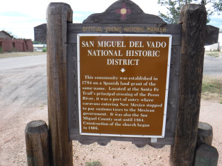 San Miguel Del Vado is the first (New) Mexican Community encountered by the American traders since 1821. It was the Port of Entry for American Traders. |
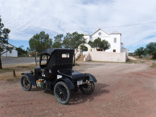 Church at San Miguel Del Vado, New Mexico. | 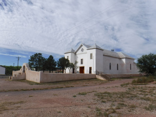 Side view of the Church at San Miguel Del Vado, New Mexico. It was built in 1805. | 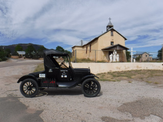 Church at San Jose Del Vado, New Mexico. |
 Old Route 66 bridge crossing the Pecos River East San Jose Del Vado, New Mexico. |  Pecos Mission Church (ruins) at Pecos National Mounument (an old Pueblo) South of Pecos, New Mexico. |  Old General Store in Pecos, New Mexico. |
 Pigeon's Ranch Stage Station West of Pecos, New Mexico. The original had dug well is the ring of rocks in the foreground. | 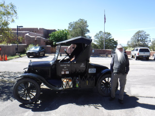 The Model T and Me at the National Park Service Office in Santa Fe, New Mexico. | 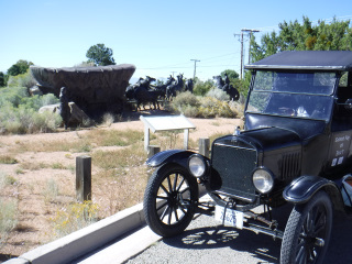 "The Journey's End" sculpture only a few blocks Westof the NPS Office in Santa Fe, New Mexico. |
 The La Fonda Hotel in Santa Fe, New Mexico. This photo was taken from the Central Plaza in Downtown Santa Fe. |  Burro Alley - West of the Central Plaza in Santa Fe, New Mexico. |  Looking North down Burro Alley. |
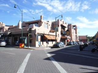
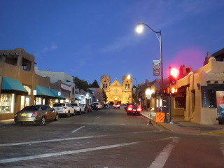 From the Central Plaza in Santa Fe, looking East at dusk, with the La Fonda Hotel on the right and the Cathedral Vasilica of St. Francis of Assisi at the end of the street. | ||
| 09/20/24 - Friday - Day 13 I didn't travel anywhere today. I stayed in Santa Fe and explored the downtown/Plaza area. I had seen all these places in 1984, but I wanted to visit them again. Only one block East of the Central Plaza (where all the wagons would come into in the 1800's) is The Cathedral Basilica of St. Francis of Assisi - built in the 1800's. About a block and a half South of the Plaza is the Loretto Chapel This structure has a staircase that has no seeable support. By rights, the stairs shoud simply fall apart when someone steps on it. It was built in 1873 and the staircase is still functionable. A little farther South (only 1 block) is the San Miguel Church which was built in the 1600's. Behind this church to the East is the Oldest House, also built in the 1600's. From the Oldest House I walked several blocks to the West to see the New Mexico State Capitol Building. The staircase going up to the Capitol is where we loaded Joker the donkey in 1984. We backed a pickup truck, with a livestock rack in the box, up to the steps, walked Joker to the top of the stairs and then simply walked Joker right into the pickup box. From here I walked back to the Plaza. Across the street North of the Plaza is the Palace of the Governors, also built in the early 1600's. The Palace is built in a square with a large courtyard in the center. In 1984, after our welcome into Santa Fe by the Governor's office, the Mayor's office, the Chamber of Commerce, and, and, and, the 4 of us walkers were treated to a Mexican beer at the La Fonda Hotel by Santa Fe Trail Historian Marc Simmons. Susie, Marc's neighbor, was holding Joker while we went for the beer. When we returned, Susie and Joker were gone. Marc wanted to show us the Palace of the Governors before it closed for the day. We walked inside and there were the missing 2. Susie was holding Joker under the large elm tree in the foreground of the photo. There were big signs at the entrance "No Animals Allowed". I have no idea how Susie got the donkey in there. It wasn't like she could hide it in her purse and smuggle him in. There were 3 cameras with us and nobody got a photo of that. What Were We Thinking??!! I'll be leaving in the morning (Saturday) to start my drive back to New Franklin, MO. I'll be taking the other route - the Cimarron Cut-Off which will take me through the panhandle of Oklahoma and points NE back to Dodge City, KS. I have a few more days to go before I get back. I will continue to post until I get back to Missouri. | ||
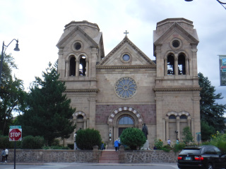 The Cathedral Basilica of St. Francis of Assisi in Santa Fe, New Mexico. | 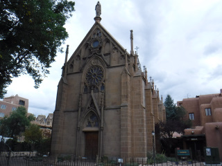 Loretto Chapel in Santa Fe, New Mexico. | 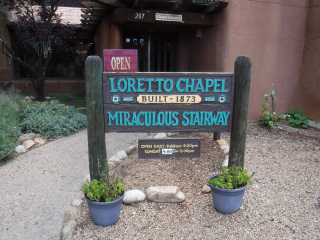 Entrance to Loretto Chapel in Santa Fe. |
 San Miguel Church in Santa Fe, New Mexico. | 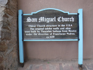 Sign at San Miguel Church in Santa Fe. | 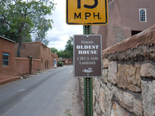 Sign for the Oldest House (1646). Oldest exisisting house in the United States is the building on the left. The San Miguel Church is on the right. |
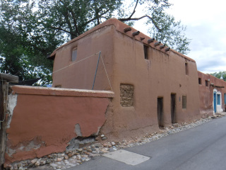 The Oldest House - located in Santa Fe, New Mexico. | 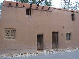 The Oldest House. |  The New Mexico State Capitol Building in Santa Fe, New Mexico. |
 The stairs at the Capitol Building where we loaded Joker the Donkey in 1984. | 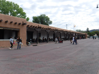 The Palace of the Governors in Santa Fe, New Mexico. For many years, it was the oldest continually running Government office building in the United States. | 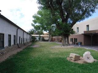 The inner Courtyard of The Palace of the Governors. The tree in the foreground on the right was the tree we found Joker and Susie under in 1984. |
| 09/21/24 - Saturday - Day 14 I drove from Santa Fe, NM to Las Vegas, NM today. It was 76.7 miles. The sun was shining in Santa Fe when I left town abut 9:00 AM. There were no gas stations along Santa Fe Trail Road, which is the actual trail coming into the Plaza from the South. I stopped in the town of Pecos, NM for gas. There was a farmer's market going on in the parking lot next to the gas station. Several people from the market came over to look at the Model T. One of the vendors asked me if I'd drive over so all the other vendors could look at the car; so I did. I was in town for about an hour. I lady with a bright red jacket wanted her photo taken with me at an angle that the wording on the back of her jacket could be read - "Glorietta Pass Fire and Rescue". There was a lady picking a guitar and singing and selling her CD's (country music). She gave me two of her CD's (each different) for possing with her and the car. I look forward to getting home so I can listen to them. She sounded really good performing at the market. The highway was wet coming into and leaving Pecos. They ovbviously had rain in the recent past. I dind't drive 10 miles and I ran into the rain. It wasn't hard, but it was getting the windshield wet. I pulled over into a pull out area along the frontage road and put the side curtains back on the car. I think I drove over 30 miles before I ran into a ight rain again, and I drove out of it in about another 5 miles. I saw numerous cars parked along the frontage road and along the sides of the Interstate today - and on Thursday when I was driving into Santa Fe. People were walking through the Pinion trees with plastic and paper bags picking Pinion nuts. When I stopped to put on the car side curtains, I took a little walk and found a Pinion tree and pulled one of the pine cones off the tree. The cone was open and exposed the loose nuts inside. I ate about 6 of them. Very Tasty! The cone I picked was covered in very sticky sap (not the nuts). It took me a long time to rub it off my fingrs. I didn't want to get the steering wheel all sticky.. I inteded to go considerably farther, but I stopped to do laundry in Las Vegas (they have a laundromat along the street I needed to drive - how convenient!). This took a little over 2 hours. By the time my clothes were washed and dried, the sky got very dark. I think I'm going to get wet. So, I got a motel for the night and started working on a Google Map of sites I want to see on the Cimarron Cut-Off. If you're wondering, Yes, it did rain some more. Not heavy, but it came down for a long time. I'm very glad I stopped for the night. | ||
 Lady wearing "Glorietta Pass Fire and Rescue" jacket in Pecos, New Mexico. | ||
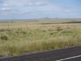
| 09/22/24 - Sunday - Day 15 I traveled from Las Vegas, NM to Clayton, NM today. A distance of 166 miles. It must have rained more after I went to bed last night. Everyting was pretty wet when I got up at 6 AM this morning. I ate breakfast and then went out to the back parking lot of the motel (gravel) to change oil in the car. I couldn't find any oil changing business that wanted to change the oil in the Model T. One said the lift wouldn't work on the T. I asked if they could just crawl under the car. That WAS NOT an option. I asked if they could let me borrow an oil drain pan and I would drain it myself. Also, NOT an option. They kept throwing the word "Liability" at me. Another place told me their staff were not trained for that year of automobile. Once again, I asked if I could borrow a drain pan and do it myself and, once again, the word "Liability" raised its ugly head. I finally gave up looking and asking and went to Walmart to purchase 4 quarts of oil and a $2.97 plastic oil drain pan. The motel I stayed at gave me permission to use the back parking lot to drain the oil. The motel garbage dumpster was back there and had a very largae cardboard box sitting near the top. I tore it apart and used it to lay on under the car. Sure beat laying in the wet gravel and mud. Once I put the new oil in the car, I poured the used oil into the plastic bottles, capped them, placed them in a plastic bag and threw them in the dumpster. About 20 minutes and I was back in the motel. It was very cloudy and very nippy out this morning. I took the side curtains off the T and drove the whole day with them off. Later in the afternoon it got pretty breezy - from the North. I was heading more East than any other direction, so the wind blew into the T from the driver's side. I wore a hooded sweatshirt all day. The extra layer felt really good. A few miles North of Las Vegas the frontage road ends and I had to drive the interstate for about 5 miles. There was water standing in the concrete culvert under the interstate. I had to drive through it to get on the interstate. I drove very slow. When I got on the other side, I got out to see how much of the car got wet. The axle wasn't even wet. I was happy! The first town I came to was Watrous, NM. I drove a block off the main road to get a photo of the city park where we camped in 1984 with the donkey. On the North end of town, the road is lined on both sides with Black Willow trees. The trees were ordered by a person in Tiptonville (between Watrous and Fort Union - not there anymore). They were shipped to Fort Union (about 10 mies North of Watrous). The guy had his son plant all the trees - he didn't want his son to be bored. Between Wagon Mound, NM and Springer, NM I saw the AmTrak train coming toward me on the track. I pulled out my camera for a couple photos. I wish I had it on "video", because the train honked at me as it passed by. I could see the Engineer waving in the window. I thought that was pretty cool! A few miles East of Springer is a canyon that goes off to the South. The wagons traveling the Trail took the canyon toward Santa Fe. Farther East on Hwy 56, and then about 10 miles North on a rocked county road, is the site of Point of Rocks. There was a large spring coming out of the rock point on the right side of the photo. The 2nd photo is taken West of the rock point. Every place you see an inlet along that rock "island" had a spring. None of them were as big as the one on the point. Wagons camped all along the South and West sides of the Rock. I tried to get closer for a better photo, but the road was very muddy and I could see nothing but water on the road farther ahead. I turned around and went back to the highway. As I turned around, I took advantage of the stop and got a couple photos of the car wtih the Rock. I didn't have to drive very far East to begin seeing Rabbit Ears in the distance. This double mound formation is North of the town of Clayton, NM. The first photo I took of it was maybe 40 or more miles away. You can see it for a very long distance. The stretch of road from Springer to Clayton runs primarily East/West. Did I mention that the wind was really blowing from the North today? The wind blowing my beard made it a little challenging to see the road this aftenoon. I saw an antelope (1) today by Las Vegas. I saw a small herd of them East of Springer. As I was loading the Model T this morning, the lid on the trunk fell closed and landed on my right elbow. It really hurt. When I was done changing oil and back in the motel, I took my parka off and saw my shirt was bloody at my elbow. Not good! Here it is 5:30 PM and it still hurts just as much as it did when it happened this morning about 7:00 AM. I stayed at the Eklund Hotel in Clayton, NM tonight. Another historic hotel. Very Nice! The hotel's WIFI and internet was down, so I'll have to wait until tomorrow night to make today's post on Facebook. | ||
 Rain water standing on highway under I-25 North of Las Vegas, New Mexico. |  City Park in Watrous, New Mexico. |  Black Willow trees planted along the road (now highway) leading into Watrous, New Mexico from the North. |
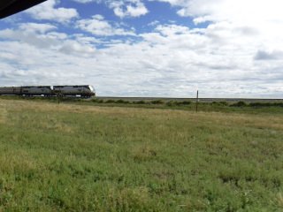 AmTrak Train headed South between Wagon Mound and Springer, New Mexico. | 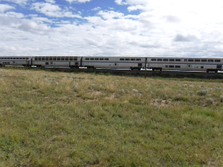 AmTrak Train headed South. |  The canyon that the Santa Fe Trail wagons travelled through to get to Wagon Mound. This entrance to thecanyon is East of Springer, New Mexico. |
 The "Point of Rocks" campground. The main springwas off the point on the right. It is located East of Springer, New Mexico. | 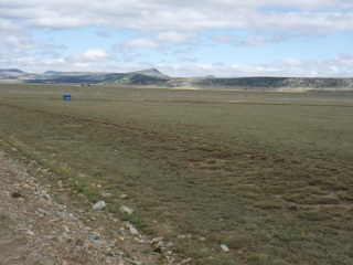 This photo can be extended from the left side of the previous photo. There were springs coming from thishill for the entire distance spanned by these 2 photos. | 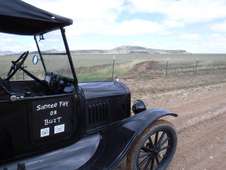 "Point of Rocks" is where the hill seems to end on the right side of this photo. |
 Rabbit Ear Mountain in the distance. This photo was taken from close to "Point of Rocks". | 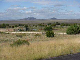 Rabbit Ear Mountian - taken as I was getting closer to the town of Clayton, New Mexico. | 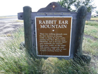 Sign for "Rabbit Ear Mountain" West of Clayton, New Mexico. |
| 09/23/24 - Monday - Day 16 I drove from Clayton, NM to Ulysses, KS today. A distance of 191 miles. Driving North out of Clayton, I noticed the highway beside me. Just me and my shadow. About 10 miles North of Clayton is a Santa Fe Trail Interpretive site....with an outhouse!! The Forest Service marked the trail ruts with vertical limestone posts. They invite peple to walk in the ruts at this site - maybe half mile or so. Next stop was McNees Crossing. I found the sign along the highway, but couldn't determine which gate took me to the actual site. I didn't want to trespass if I chose the wrong gate, so I stayed on the highway. I've been noticing for the past 2 days how desolate this area seems. Hardly any trees and miles and miles of grass and hills. I saw 7 tarantulas ans 12 antelope between Clayton and McNees Crossing - about 15 miles. Next palce to visti was the Heritage Center in Boise City, OK. They have this HUGE dinosaur nexat to the building. You need to read the description of the dinosaur in the photo. I crossed into Oklahoma today. It didn't take very long and I crossed back out of Oklahoma and into Kansas. West of Elkhart, KS I vistied Middle Spring - another watering hole for the 1800's wagon travelers. They had a hand pump on the property, so I pumped up some water into a pop bottle. Pretty good tasting water! I then drove another mile to the site of Point of Rocks. There are interpretive signs at this site also. One of the signs has a photo of cowboys that worked at the Point of Rocks Ranch in the late 1800's. When I was reading the McNees sign earlier today, a guy came by in a pickup and struck up a conversation about his grandparents and great grandfather. His family has lived in this area for several generations. He told me that when I get to Point of Rocks, I needed to pay attention to the photo of the cowboys and guy still laying in his bedroll. The guy in the bedroll was his great grandfather. He was told as a kid that his great grandfather did not want his photo taken in his underwear, so he pulled the blanket back over himself for the photo. The guy told me that his family always enjoyed telling that story. From Point of Rocks I stayed on the dirt road numbered 600-1 by the Forest Service. I was on that road for almost 20 miles or more. The Santa Fe Trail crosses over this road numerous times in the 20 miles. They put vertical limestone posts in the center of the ruts so people can find the trail easier. I found it very interesting seeing where the early travelers chose to take their wagns in relation to the terrain. I even got to experience having to wait for the "buffalo" to get out of the road in order for me to continue. I started my drive today about 8:30 AM. I had several lengthy conversatons and several stops for photos. I got into Ulysses about 6:30 PM Mountain Time (7:30 CT). I crossed over from Mountain Time to Central Time at some point today. Not sure where. | ||
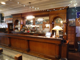 The old bar/saloon inside the Eklund Hotel in Clayton, New Mexico. |  Part of the dining area in the Elkund Hotel in Clayton. | 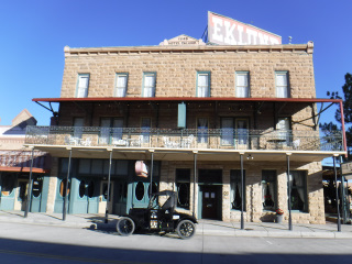 The outside (South) side to the Eklund Hotel in Clayton, New Mexico. |
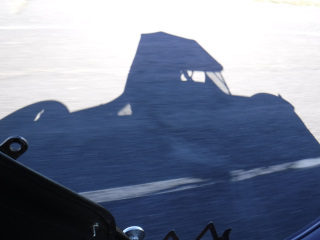 Me and my Shadow driving North from Clayton, New Mexico. |  Santa Fe Trail Interpretive Area set up by the National Forest Service about 10 miles North of Clayton, New Mexico. | 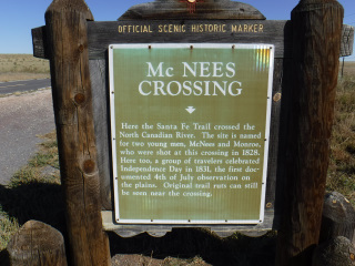 Sign at McNees Crossing along the road. This is North and East of Clayton, New Mexico. |
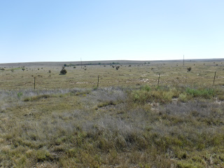 McNees Crossing is located where you see the line of trees in the background. | 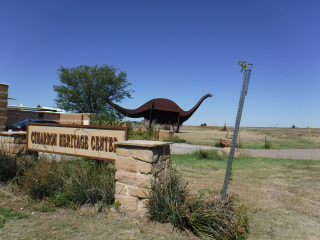 Cimarron Heritage Center in Boise City, Oklahoma. | 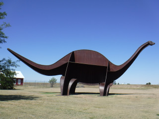 The Dinosaur at the Cimarron Heritage Center. |
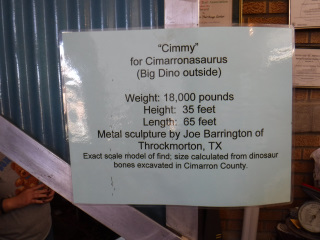 The sign describing the Large Dinosaur in Boise City, Oklahoma. | 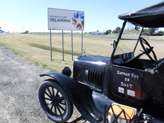 Entering Oklahoma. |  Entering Kansas. |
 Middle Spring - West of Elkhart, Kansas. |  Modern hand pump at Middle Spring. | 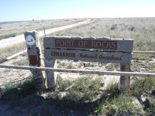 Point of Rocks - West of Elkhart, Kansas. |
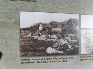 Interpretive sign at Point of Rocks. You can see the man laying in his bed roll in the foreground. (Read story above) |  Cows in the "Trail". Driving on Forest Service Road 600-1 - West and North of Elkhart, Kansas. | |
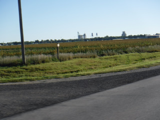
| 09/24/24 - Tuesday - Day 17 I drove from Ulysses, KS to McPherson, KS today. A distance of 234 miles. I started at 8:15 AM and arrived in McPherson about 3:45 PM I had very few stops today. I visited most all the places there are to see on the way to Santa Fe. This return trip should be pretty fast. One of the places I missed on the way to Santa Fe was just West of Dodge City. Several months ago (maybe it's been years instead of months), the Kansas Highway Department decided to widen the highway next to a monument telling of Santa Fe Trail sites, and so the monument had to be taken away. I was informed just a few days ago that a new monument has been placed along the new highway just a few feet from where the original had been. On my way back through Dodge City, I stopped to get a few photos of it. Today, there is a stone monument AND an interpretive sign that gives a very detailed description of the significance of each of the sites listed on the stone monument. I stopped for gas in Kinsley, KS. This beautiful 1957 Chevy comes pulling in. I went over and complimented the guy on the nice looking car. He said he did all the work himself, including the paint job. Then he said that if I looked inside, it won't look like a 1957 Chevy...and it didn't. He took a 2013 car (he told me and I don't remember) and put the 1957 Chevy body on it. The car has air bags, back-up camera, AC, almost nothing tht you would've seen in a real 1957 Chevy. But, it sure did look nice!! Farther East I drove through Great Bend, KS. On the East side of town is a roadside park with an interpretive sign for Fort Zarah. The next town East is Ellinwood, KS. These folks have a very interesting mural on the side of one of their downtown buildings. When I got to McPherson, I went to their Walmart to see if they wuld do an oil change on my Model T. The manager said YES! I had to talk him through it, but at least this guy was willing to learn and wasn't afraid of Liability issues as the places in Santa Fe and Las Vegas were. This should be the last oil change I need till I'm finished wtih the trip. I took some photos, but with my phone, not my camera. I'll make a seperate post on Facebook about the oil change. Google tells me that I have 290 miles to drive from McPherson to Boonville, MO. I should be finished in about 2 days, if nothing happens. I know rain is in the forecast for Eastern Kansas and Western Missouri on Thursday. I just hope it doesn't start until late in the afternoon on Thursday. | ||
 The new Caches Monument and Interpretive signs. West of Dodge City, Kansas. | 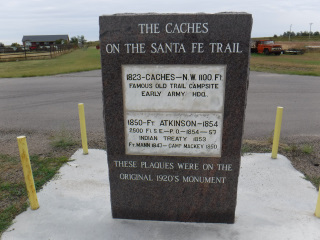 New Caches Monument - West of Dodge City. |  Interpretive sign with photos of the old Caches Monument - West of Dodge City. |
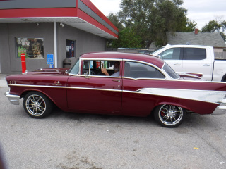 1957 Chevy body put on a modern 2013 car chassis. Kinsley, Kansas. | 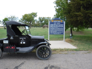 Fort Zarah Interpretive sign - East of Great Bend, Kansas. | 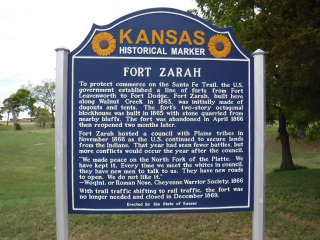 Closer view of Fort Zarah Sign. |
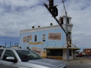 Mural in Ellinwood, Kansas. | ||
| 09/25/24 - Wednesday - Day 18 Today I drove from McPherson, KS to Gardner, KS. A distance of 182 miles. I started a 8:15 AM and arrived in Gardner about 3 PM. I made a stop in Council Grove, KS at the Kaw Mission and another stop in Burlingame for gas. I don't think I've ever come to the town of Canton, KS from the West. I've always traveled East to West. I was pleasantly surprised to be able to see the Hot and Cold water towers from Hwy 56 - even though I couldn't read the words from that far away. West of the town of Burlingame, KS I saw a pen with a high fence around it. Then my eyes focused into the shade of a large tree to see a bull elk and 2 cow elk. I had to turn around on the highway to come back for a photo of them. The main stret of Burlingame used to be the Santa Fe Trail. The town grew up around the path of the trail. I posted 3 photos of Burlingame: 1) From the gas station at the East end of the Brick Main Street looking West down the Santa Fe Trail. 2) From the same point looking East down Main Street/Santa Fe Trail. 3) From a short distance East of the gas station looking East where the Rail Road built a bridge over the Santa Fe Trail as it entered Burlingame from the East. The highway going under the RR bridge today was the trail in the 1800's. There are lots of fences in this area built out of limestone rocks. I tried getting photos of some of the fences, bu none of them turned out. The highway in this area has very high car and semi traffic - and no place to get off the road or to turn around or stop. All the photos I took were "on the fly". I had just taken a series of photos of a limestone fence that was between the highway and a farmstead with an old barn. It would have been a great shot if I wasn't moving so fast (35 MPH). I still had my camera turned on after taking the fence photos when I spotted a Daughters of the American Revolution (DAR) granite marker wth a post and sign by it. I snapped a photo, but it turned out blurry also. I posted this one to give you an idea of what I'm talking about. Just what you wanted to see, right? A blurry picture. When you're looking at it, pretend that you had too much alcohol to drink and the photo will look just fine!! I'm still on schedule to finish my trip tomorrow. I will have Kansas City to drive through and then on to New Franklin, MO. Google Maps tells me it's 130 miles. I'm sure it will end up being more than that. I can't drive the interstate. I will need to make a few jogs on side streets to get through the big city. | ||
 Hot and Cold water towers in Canton, Kansas. | 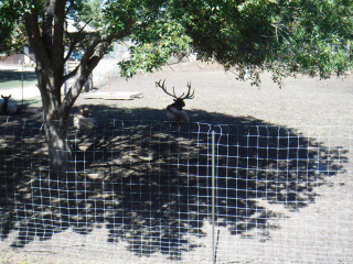 Elk resting in the shade - West of Burlingame, Kansas. | 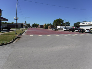 Main Street of Burlingame, Kansas - Looking West. Main Street WAS the Santa Fe Trail. The town built around the trail. |
 Main Street of Burlingame, Kansas - looking East. | 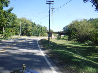 Where the Rail Road built its tracks OVER the Santa Fe Trail . The road is/was the Santa Fe Trail that went down the center of Burlingame, Kansas. | 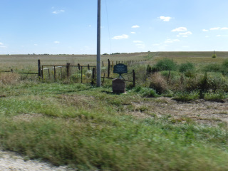 The mystery sign with a DAR Marker East of Burlingame, Kansas. |
| 09/26/24 - Thursday - Day 19 Today I drove from Gardner, KS to New Franklin, MO. This was a distance of 158 miles. I started driving at 9:15 AM and finished at 2:45 PM. I was given a 'Heads Up' from a Model T driver who lives in the Kansas City area that traffic doesn't slow down until about 9:30 AM. I'm not fond of big city driving even in my regular car. In a Model T, I'm even more nervous. Luckily, the Santa Fe Trail follows streets (or more correctly, modern streets follow the old Santa Fe Trail) that are not major arteries of the city. I was able to get through the city without much traffic at all. I'm guessing that about half of the streets I drove were 4 lane streets. I could get in the slow lane and let those who wanted to pass me, pass me. I found there were numerous people who just followed me. Maybe to watch a Model T drive down the street? I don't know, but the entire drive through Kansas City was much less stressful than I had anticipated. When I got into Independence, I spotted this spiral quite a long way away. It is part of a church near downtown Independence. Once I got out of the city, it didn't seem like it took very long and I was crossing the Missouri River at Boonville, MO on my last 3 miles of the journey into New Franklin. When I got into town, I parked as close as I could to the Giant Granite Marker on Main Street marking the beginning of the Santa Fe Trail. And, so as I began, my journey comes to an end. I hope all of you following my on Facebook enjoyed my stories and photos. I only posted a portion of each day. The days just weren't long enough for me to write all that I experienced. What a Great Journey! Thank you for following me!! JOURNEY TOTALS DAYS = 19 - 18 Traveling + 1 Rest in Santa Fe, NM MILES = 2210 | ||
 A church in Independence, Missouri. | 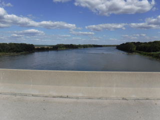 Crossing the Missouri River from Booneville to New Franklin, Missouri. | 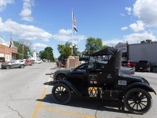 Back on Main Street of New Franklin, Missouri in front of the giant granite rock (looking East). |
 Main Street of New Franklin, Missouri (looking Southwest). | 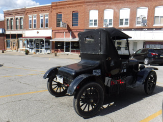 The 1923 Ford Model T Roadster after over 2000 miles of the Santa Fe Trail. (You done well, old girl - You Done Well!!!) | |